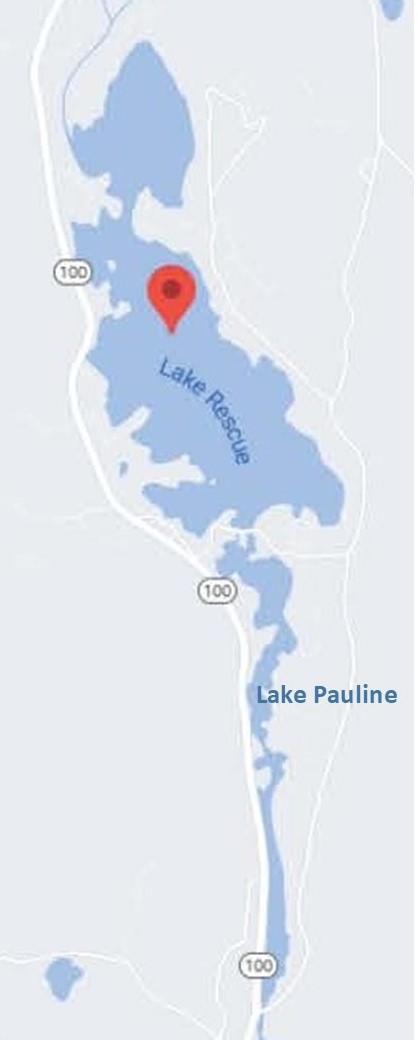
Lake Rescue and Lake Pauline
Lake Rescue is located in Windsor County of south central Vermont. Occupying 180 acres (73 ha) and reaching depths of 95 feet (29 m), it is the tenth-deepest and 23rd-largest lake in the state. Lake Rescue is located along VT Route 100 about three miles north of Ludlow and Okemo Mountain, and it is surrounded by the town of Ludlow. The lake is fed by the Black River and is the third of four lakes extending from Plymouth, Vermont through Ludlow, with Lake Amherst and Echo Lake to the north and Lake Pauline to the south.
The northern section of the lake, connected to the main body via a shallow channel, is referred to as Round Pond. The lake is used year-round predominantly by the residents of the approximately 110 lakeside homes and camps who enjoy swimming, waterskiing, fishing, sailing in summer and ice-fishing, skating, and snowmobiling in winter. Although no public swimming beaches exist, the lake does have a state-maintained public fishing access point where boats can be launched. Fish include bass, perch, brown trout, rainbow trout, pickerel, and sunfish. A "horseshoe" dam separates Lake Rescue from Lake Pauline, over which passes the well-known and much photographed Red Bridge, built in 1835.
Lake Rescue is north of Red Bridge and power boats (but not jet skis) are permitted on the lake. Lake Pauline (also known as Reservoir Pond) is to the south of Red Bridge and only non-motorized propelled craft are allowed. There is no true public boating access on Lake Pauline, which is bounded by the Red Bridge dam to the north and the Reservoir Pond Dam to the south.
Lake Rescue Facts
- Water quality: classification is B
- Lake type: Natural with Artificial Control
- Primary Water Source: Black River
- Surface area: 184 acres (74 ha)
- Watershed area: 22,859 acres (9,251 ha)
- Maximum depth: 95 feet (29 m)
- Mean depth: 24 feet (7.3 m)
- Volume: 4,416 acre feet (5,447,000 m3)
- Maximum length: 5,900 feet (1.8 km)
- Maximum width: 2,200 feet (.67 km)
- Surface elevation: 1,043 feet (318 m)


Lake Pauline Facts
- Lake Type: Artificial Reservoir, Dammed
- Water Level Control: Town of Ludlow
- Surface Area: 32 acres
- Shoreline Length: 2 miles
- Normal Elevation: 1,077 feet
- Maximum Depth: 47 feet
- Water Volume: 140 acre-feet
- Completion Year: 1920
- Drainage Area: 37 sq.miles

